 We here at Urbanismo have been fortunate to work on the designs for two of Richmond's most venerable public places, Monroe Park and the square that was historically occupied by the Richmond City (later Seventeenth Street) Market. The senior of us was employed at 3North, the architecture and planning firm that executed the master plan for Monroe Park in 2008. Several years later, both of us were employed at StudioAmmons and produced a design project in response to a request for proposals from the City government for the Seventeenth Street Market Square. Although our design solution was not selected for the Seventeenth Street Market, we were hopeful that the final product would be as a sensitive to the underlying context carried by the site as the Monroe Park project turned out the be. Neither of us were involved in the implementation of either park.
  |
| Monroe Park, restored fountain looking north |
We remain convinced that the best responses to urban interventions involve "excavating" the design solution from the site, carefully examining and weighing the value of the preexisting patterns at the site and making use of those patterns to give continuity and to avoid gratuitously and inharmoniously disrupting healthy urban and architectural patterns for generations to come. By this standard, the Monroe Park project receives high honors and the Seventeenth Street Market project fails miserably.
 |
| The 2009 3North Design for Monroe was largely executed as shown in 2017-18, with the exception of the rill running from the fountain to the lower center. |
Monroe Park
The Monroe Park Restoration has been nearly a decade in gestation, but finally opened late last year after nearly two years of being fenced off from the public.
 |
| Monroe Park soon after opening in October 2018. The restored Checkers House, occupied by a police station and coffee shop. New lighting, walking surface, and terrace around the Checkers House. |
 |
| Restored Checkers House from the north, Oct. 2018. |
The result is worthy of celebration. The reopened park is truly a restoration of all that is best of a great urban amenity. Major paths are lined once again by allees or rows of matching trees. The concrete and asphalt paving of the park's paths, arranged in the complex radiating plan implemented in 1877 by city engineer Wilfred Cutshaw, has been replaced by firmly packed yet soft-to-the-foot fine gravel. The brick Checkers Building of 1939 has been restored, and a completely new, classical pavilion of openwork bronze has been erected at the SW corner of the park across from the Altria Theatre (the Mosque Theatre of 1927).
 |
| Monroe Park as it appeared at its peak in 1896. Seen from the east. |
The park, founded in 1851, was one of a series of three “breathing places in the midst of the City or convenient to it,” acquired as essential civic amenities by the common council. Modeled on similar squares in Boston, Philadelphia, Baltimore, and New York, Richmond's ten-acre "Western Square" was designed to provide an open, green place for the health and comfort of the citizens. It took many years for it to be landscaped and improved.
It was not until after the end of the Civil War and after use as a fair grounds and military camp that it began to be used as a fair-weather promenade and visual amenity in direct competition with the city's original urban park at Capitol Square. The adjutant general of the US Army obtained funding to make modest improvements to the square in the early 1870s. In 1872, he donated a rock fountain at the center of the square. Charles Dimmock, the city engineer, prepared a plan of improvements for Monroe Square in 1871. and its gradual improvement commenced under his direction.
 |
| Elm trees and privet hedge along the Franklin Street side of Monroe Park [VCU Library] |
By invisibly updating the park the city has demonstrated the greatest restraint at a time when subtlety in landscape design is in recession. The park support groups and the late Tyler Potterfield, senior planner, deserve great credit for the general preservation approach for the park. The project treated this great public amenity with the respect owed to the foresight of the designers preceded us. There was no need here for contemporary design features, intrusive public art, and superfluous elements like splash pads that pander to a supposed need to educate or entertain the public in order to convince them to make the fullest use of the park.
 |
Bryant Park, New York City, plan [above] and photo looking east [below] |
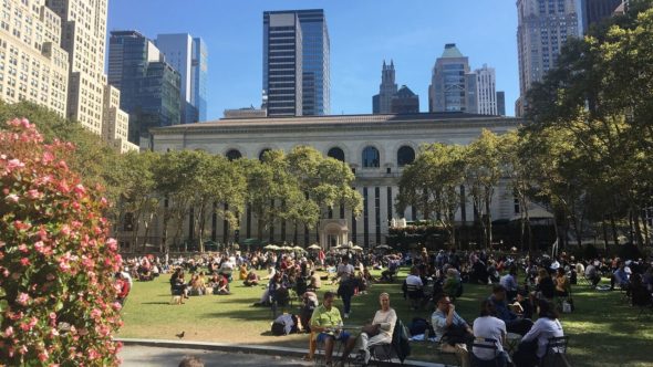
The initial design by 3north, headed up by architect and landscape architect Jay Hugo, was to replicate the success of other urban plazas like Bryant Park in New York City, which reopened in 1992 as "programmed" park with provisions for eating, playing, and relaxing, including food, New York Public Library kiosks, boule courts with instructors, loose seating, and a wide range of seasonal activities.
 |
| 3north- watercolor rendering of rill, 2009. |
 |
| 3north- watercolor rendering of the restored Checkers House and the new café- very close to the project as executed, 2009. |
The author was involved in the design of the rill, and also in the restoration of the Checkers House (the original park keeper's station) as a café and police station, and in the selection, with the City's architectural historian, Tyler Potterfield, of the varieties and layout of the recreated allees which line the major paths, based on the original tree layout. The logic of the plantings had been lost over the more than one hundred years since its planting and the park was characterized by a motley collection of trees some of which were unhealthy and, and in the case of the many hollies and magnolias, inappropriate for the use.
 |
| View east through the park. October, 2018 |
Our connection with the project ended with the design phase and we have observed the slow progress of its realization from afar, hopefully. When we visited one beautiful week day, the park was occupied almost entirely by students from the nearby university, playing Frisbee, reading, or sampling the coffee. The concession operator explained that part of her duties were providing equipment for games, including bocce, chess, and table tennis. We vote this one of the nation's best and most understated park restorations.
Seventeenth Street Market
"As well as the encroachment of commercial material in traditional urban spaces the understanding of urban values is also under threat from the type of commercial space common to the cities of the leading developed economies. . . . In this context the elements of public space are often appropriated as a component of the developer's armoury in creating a successful segment of the city, yet they are exclusive environments without the diversity which authentic urban situations contain as a matter of course." Eamonn Canniffe, The Politics of the Piazza: The History and Meaning of the Italian Square, Ashgate, 2008.The “Market of the City of Richmond” was founded by city ordinance in 1782. We explored its history here and the threats to it here.
As we have explored in detail in this post, the proposed Seventeenth Street Market Square represents the sixth intervention at the site of Richmond’s historic city market. From its earliest days on the bank of Shockoe Creek, the City Market has been an accretionary, transformative place, changing its character with the changing shape of the city. The Market Square was originally placed on the edge of the settlement. One contemporary remembered the “green pasture” of the town's Common, which extended from the Market House down to Shockoe Creek. Eventually the area around the market was lined with shops and it took on a more enclosed form.
 |
| Richmond City Market in 1814. Detail of Market House of 1794 from
Virginia Mutual Assurance Society policy. The three arches to the right were an addition.
|
Like its predecessors in Europe, Richmond's First Market Square embeds centuries of change and growth, although over time it assumed the form of a conventional enclosed square. In fact, American public places like First Market Square have traditionally embodied the kinds of urbane social and economic values that we usually associate with European plazas.
The market, which began in the half-block between Main Street and Arch (Walnut) Alley, was extended over time as far as Grace Street, two blocks to the north. The Market Square was eventually surrounded by brick buildings housing grocers and butchers' shops. By 1853, the market building was judged by a city committee to be inadequate. The main section of the market was replaced an Italianate-style two-story building was likely designed by the City Engineer, W. McGill. This replaced, in turn, by three other structures in succession. The last market building was demolished in 2017 in order to create, for the first time, an open square on the same site.
 |
| 1854 Market Hall |
 |
| 1913 Market Hall |
As part of the rich, bottom-up, market-driven development that has characterized the area along Shockoe Creek since the late seventeenth century, the area around the Seventeenth Street or First Market is an increasingly vital neighborhood in its own right. Given the loss of the historic market halls, most of what was significant about the market area was embedded in its street layout, its pavement, and its shape. The curbing, street pavement, and sidewalks carried its history as strongly as the buildings that surround it.
Preservation of these urban textures and forms was essential to provide continuity and context. There are subtle formal and historical distinctions that must be made in order to take full advantage of the gifts this valuable civic resource offers to the city.
This place has been at the heart of commerce in Richmond for over two hundred years. Shockoe Valley, with its growing young population, should retain a vital market function, preferably with a number of traditional permanent stalls, not just temporary shelters.
In contrast, the project's planners treated the square as a "festival marketplace"- a wide concourse leading from Main to Franklin and beyond. This kind of planning led them to treat the square as if it was just a link in a grand scheme seen from a privileged, bird’s eye perspective.
The square did not evolve as an open piazza. While the edges of the square are formed by building facades on the south, east, and west, there is no closure at the north. It is long and narrow and “leaky” at the corners. The square was meant to be filled with architecture. This does not mean that it couldn't be adapted for use as a piazza designed to serve the civic good.
The Market Square consists of two historic sections. The earliest part of the present square is the southern half. Its legal boundaries laid out in 1792. It contained the two-story building that served as the market house, municipal building, assembly hall, records office, and seat of justice. This building was later rebuilt and expanded to the north as far as Franklin Street.
Most importantly, its two main sections were linked by a central archway in the form of a tower that spanned “Arch Alley” midway along the market, permitting movement from east to west across the square. The elongated form of the now-vanished market buildings is defined by the cobbled streets and the granite curbing, each of which dates to the heyday of the market in the nineteenth century. The market gradually extended all the way to Grace Street in a series of shed-like buildings that diminished as they moved north.
 |
| Arch Alley looking east before replacement of paving in the market square. |
 |
| Early conceptual version of the market square design, relating to its proposed role as entrance concourse to the failed ball park scheme. |
As it nears completion in mid-winter 2018, the renovated Seventeenth Street Market Square presents a slickly commercial appeal. Although it is a considerable improvement over the early renderings from 2013, meaningless gestures like the wiggly "water feature" in that design continue to affirm the Modernist bona fides of the designer. Shifting checkerboard squares, each with grass and a tree, punctuate the concrete paving. The old market bell is placed at ground level in a sculptural circular frame. Conventional electric streetlights are overpowered by tall area lights.
 |
| Seventeenth Street Market in November 2018 nearing opening day. |
Banning cars and trucks from travel along the existing streets through the square was a mistake. As the recent Richmond Downtown Master Plan indicates, areas without traffic do not feel safe, seem empty, and suffer commercially. "Pedestrianization” sounds humane, but, except in certain high density areas, it can be deadly to commerce. Cars underline the activity in the area and parked cars even make visitors feel safer on the sidewalks.
 |
| Seventeenth Street Market Square nearing completion |
The pavement in the square has been completely replaced in the name of handicapped access, but it has flattened out the sense of historical associations. As a historic district, existing pavement could have been maintained to the greatest degree possible, not only in the square , but along the adjacent streets where, in some cases, it is the principal reminder of the historic context.
The organizing elements of the landscape could have been used to reinforce underlying historic patterns. For instance, a central walkway from north to south could represent the central aisle that defined each of the three previous market halls on the site. In contrast paving with one flat plane from one side reminds this visitor mostly of the city's outdoor suburban malls.
As we said in 2013, by treating the project with the care it deserved, the Market Square could have become, once again, as flexible, serviceable, and exciting as any American public square or Italian piazza of today.


No comments:
Post a Comment