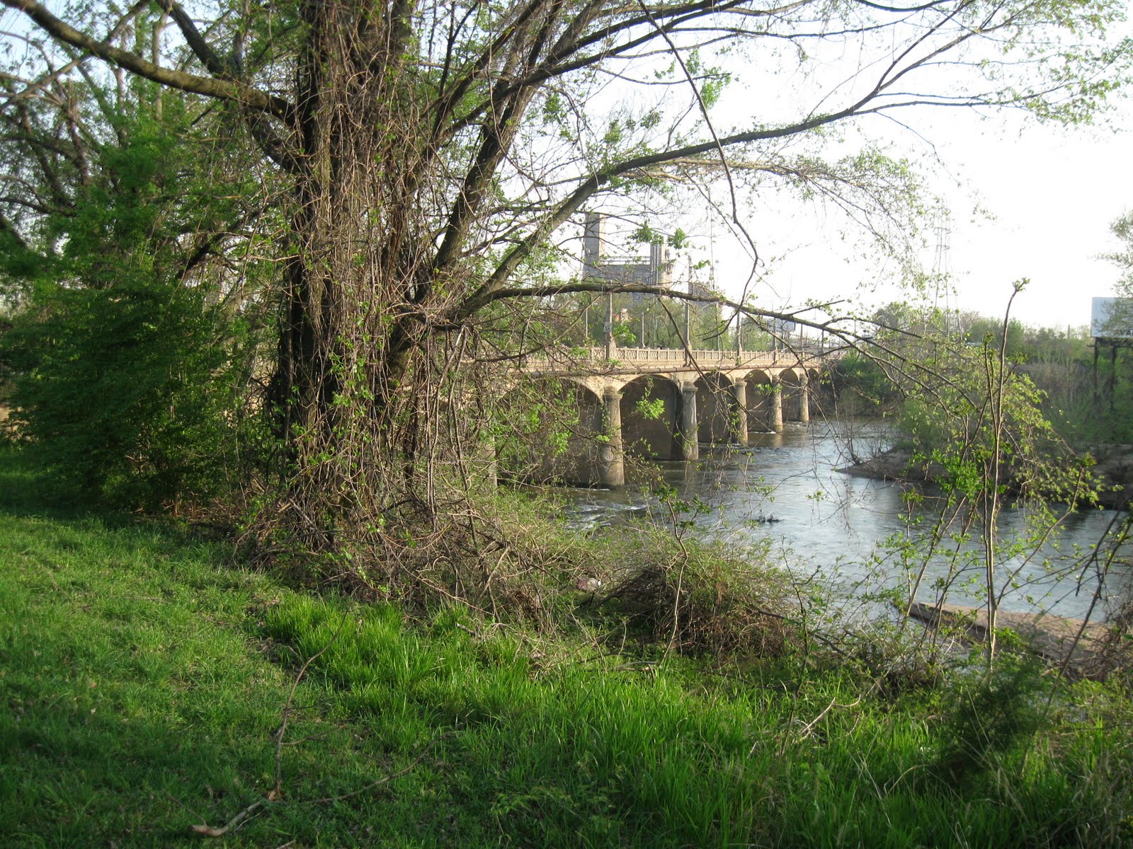
“First, What kind of life was lived in this place, that is, Why and how did its builders build as they did?
And second, what rules with general validity and applicability did they follow?”
Carroll William Westfall, Learning From Pompeii.


Friday, April 9, 2010

Exploring Shockoe Slip and the Rock Landing


         Urbanismo continued the Tuesday evening tours of the oldest parts of Richmond. This week we visited the most organic section of the city, the area settled in the seventeenth century as the trading village of Shockoes. We looked at its connection with the Rock Landing. The landing served as the dock of Richmond until the new City Dock, an extension of the James River Canal, was fashioned in 1809. This section of the city is also the most heavily altered. Its broken lineaments often call on our most active imagination to visualize or even to locate the neighborhood in its historic context. 


         We began in the Shockoe Slip, one of Richmond's most appealing places and once the center of an international trade in flour and tobacco. In the nineteenth century, the city's crowded commercial district clustered around this small triangular plaza. The apppearance of the Slip has changed dramatically since the 1880s and even within our memory. The Shockoe Wareouse vanished long ago. The area continued to serve as a manufacturing and trading center until the 1960s. The buildings were eventually rehabilitated to serve as restaurants, bars, and shops, beginning in the 1970s.

           In many ways the Slip was more visually effective before the rehabilitation than it is today. The cobbles used to pave the plaza formerly ran right up to the fountain with only the stone bollards serving to keep the wagons at bay but allowing the horses to get up close. Please remove the foundation planting and the anachronistic horse-head top element with the light globe! Hasn't anyone seen pictures of Rome? 


               This map, dating from about 1809, is one of the first to show detail in the area around the Rock Landing, labelled near the center of the map. It appears the center of the town of Shockoes consisted of the row of lots along the landing including the "Ferry Lot," the alley behind, and the narrow cross street later called Fifteenth Street. This filled the area between Shockoe Creek and the base of the bluff. The low-lying meadows behind, through which the creek meandered, were left undeveloped  for any years.  The large empty section to the north is the Mayo property on Council Chamber Hill, soon to be subdivided into lots by Col. Mayo. The oddly shaped tracts to the west, corresponding to the high ground occupied by Shockoe Slip today, undoubtedly were the result of adaptations to the steep topography.


           Above is seen a map of the area around the mouth of Shockoe Creek, made about 1820. Shockoe Slip is in the lower left corner. It shows not only the informal shapes of the alleys and streets, but also the original curving shape of Shockoe Creek and the very narrow and straight new bed it received in the early nineteenth century just to the right of lot 334. The odd-shaped lots and crooked alleys date to the distribution of land here in irregular parcels corresponding to the curving route of the old road through the area and which were divided up into lots by the owners, principally Buchanan, Ross, Coutts and McPherson. The alleys, some lined with small lots, were given names such as Lombardy, Exchange, Cypress, True Heart, Tobacco, and Byrd's. The Rock Landing was now superseded by Water Street, seen in front of lots 323, 324, and 339. The "Old County Road" is Governor Street and was the principal way up the bluff to the top of Shockoe Hill.


The map detail above by Mijacah Bates from 1835 shows the former rock landing incorporated into the bank of the city dock with the lots that fronted on it still intact.


             The curving form of the Governor Street and the continued irregularity of its extension as Thirteenth Street to Cary is clear on this map and on the 1889 Sanborn Map 15 shown later. Above is a view from Main Street looking up "the old County Road." or Governor Street.


Shockoe Slip was located on the south side of Main Street at the foot of Governor Street, down which most of the hogsheads of up-country tobacco were rolled on their way to the great warehouses that had stood near this site since the late seventeenth century. Here the area is seen on an 1859 map.


The Shockoe Warehouse occupied a small bluff near the canal basin. The series of buildings that made up the warehouse were said to cover two and one-half acres in 1837 [Richmond Whig and Public Advisor, 1837]. They were typical of warehouse at the time: low brick walled structures that contained a grid of long roofed alleys with steep hipped roofs, lit and ventilated by regularly placed windows and separated by internal courtyards.


Below is a view of the exterior and interior of Seabrook's Warehouse on Seventeenth Street, similar in form. Tobaco warehouses appear to have opened directly without interior walls into the courtyards, as seen in the 1865 view from Harper's Magazine below. Seabrook's Warehouse was built in 1810 and demolished in 1910. Its site was reserved for public use and for a time was used as a public playground. It remains empty today.


Seabrook's Warehouse


Detail from early view of city from Manchester. The flat roof in center is the Shockoe Warehouse.
 The gabled building at center right is the office. The easterly slope from the slip is
visible at center right [Sanford, Richmond, 1975].


The polygonal section of the Shockoe Warehouse, seen at the top above on the 1876 Beers' Map of Richmond, came to a point at the triangular plaza now known as Shockoe Slip. According to research by Jeffrey Ruggles, the name Shockoe Slip was not formally applied on a map until 1873. Slip appears to have been a name traditionally applied to a passage or section of street used as a public space in Richmond. However, the similar small alley, seen at the bottom above, that ran behind the Sixth Street Market in 1876 was called "Market Slip." The vast tobacco crop produced in the Piedmont region was collected and inspected at these warehouses at the end of the James River and Kanawha Canal. Jeffrey Ruggles has uncovered some interesting photos of the Shockoe Warehouse at his very useful article on the origin of Shockoe as a name.


This 1865 photo from the Library of Congress shows the burned-out walls of the Shockoe Warehouse on top of the bluff to the upper right after the Evacuation Fire.


This image shows a fine oxcart in front of reconstructed Shockoe Warehouse c 1900-1910 with the Tobacco Exchange seen beyond along Shockoe Slip.


          The map shown above is a Sanborn Insurance Map of 1889. Shockoe Slip and the enormous Shockoe Warehouse are seen to the upper left and Fourteenth Street extends away to the lower right. The canal has been overlaid with a complex web of railroad tracks.

          The map at the very top of the blog, dating from 1781, shows three buildings at the site of the Shockoe Warehouse and two at the location of Byrd's Warehouse on Fourteenth Street.  Mordecai, Richmond's Herodotus, confirms that there were two warehouses (or "inspections") in this part of town in about 1800: Shockoe Warehouse, "a mere cluster of wooden sheds," and Byrd's, a brick structure on the northeast corner of Franklin and Fourteenth streets. Shockoe Warehouse shows up as a square structure on the west side of Thirteenth Street next on the 1809 map above. Byrd's, established in the late seventeenth century, and rebuilt and relocated several times, was long gone when Mordecai wrote and another warehouse had been built on the canal basin. In addition, Seabrook's Warehouse had been constructed in Shockoe Valley.


             The Shockoe Slip fountain was put up in 1910 to provide water to the draft animals that had arrived at their destination. It replaced a fountain that was in place as early as 1876 on the Beers' Map above. The Slip provided a open area at the entry gate of the great Shockoe Warehouse. It is the triangular building in the center of the map above. The warehouse was fronted by an arcaded Italianate market building, seen above. This housed the Tobacco Exchange, built after the Civil War. The site of the exchange, where the Martin Agency now stands, was to our back as we photographed the fountain.


              The plaza is undoubtedly the result of the crashing together of the irregular lanes of Shockoes with the regular grid of 1768 Shockoe Hill. The distinguished Columbian Block, with its third-floor Grain Exchange or market, forms the angled east side of the plaza. The Slip continues south as an angled street running toward the river.  


                It is immediately noticeable that the Slip is on an elevated arm or outcrop that projects from Shockoe Hill to a point just above the canal.  This is demonstrated by the deep, sunken alley to the rear of the Columbian Block seen here from ground level in the Slip. The Slip continues in the form of an angled street until it ends in a sharp declivity about a block to the south.


             To get reach the edge of the bluff, the Slip crosses Canal Street on a concrete bridge. Canal Street was cut through the outcrop in the early twentieth century, creating a dramatic juxtaposition of levels. The warehouse previously extended out and filled the entire hillock.  


          This view, photographed from the end of Shockoe Slip, shows the site of the Shockoe Warehouse.


          Returning to the entrance to the Slip at Main and Thirteenth streets, we passed a familiar sight- one of two cannons on Main Street doing sentry duty as bollards. This one used to stand at a much more rakish angle and was unpainted, as Urbanismo recalls in years gone by. We proceeded by way of Virginia Street to the gate in the flood wall at Fourteenth Street and walked along the river bank at the base of Shockoe Slip.


            The legendary sewer-pipe walkway under the railroad gave us a good view of the substantial granite embankment that runs along the entire river edge of Richmond from the site of the Haxall Mills to the the mouth of Shockoe Creek.  The new flood wall runs close behind it west of Fourteenth Street, but angles back to leave outside a large flat area east of Fourteenth Street, formerly the site of railroad yards.
          Here is the large, unoccupied area near the Fourteenth Street flood wall gates. Haxall Mills was located to the left, south of Shockoe Slip and powered by the water in the canal. After the demise of the canal system, the area around Fourteenth Street was used as a rail yard for the many trains entering Richmond from south of the river.   


       The Richmond Dock ran from Pear Street to Fourteenth Street. Here the western end is seen in an 1886 Sanborn Map. A small basin was located east of Seventeenth, where a drawbridge crossed the long, wide canal that formed the dock. Shockoe Creek ran under the dock basin roughly parallel to Sixteenth Street. It still empties into the river in the same location.The straight line to the left of the creek's mouth represents the stone embankment.


                This drawing shows the drawbridge that allowed Seventeenth Street to cross the Richmond Dock. The company of Davenport and Morris, seen above on Dock Street in 1893. According to the maps shown above and to the testimony of Mordecai, the Rock Landing is buried immediately to the left, out of the picture, under the site of the Richmond gas works.   


             Urbanismo followed the stone river embankment past the graceful arches of Fourteenth Street (formerly Mayo's) Bridge and then proceeded back through the floodwall and along Fourteenth Street up toward Main Street.


        Here we saw the former Richmond Hardware Company Building on the right at Fourteenth and Dock street and the old Southern RR Depot (it lost its south end to the new canal project). The Rock Landing was about one square to the east (right).


Here the curving irregularity of Fourteenth Street shows its pivotal position. The angled route to Mayo's Bridge meets the 1737 grid to the right and the less regular street patterns to the left. The vacant lot in the center of the photograph above was the location of the frame building that served as the Capitol until Jefferson's temple-form building could be completed on the hill. This photo was taken before the current hotel stood on the site.   


         This Sanborn Map from 1889 shows the squares north of Cary from Thirteenth to Fifteenth streets. Lombard Alley is located in the center of the lower left-hand square. Except for the southeast quadrant east of Virginia Street, the buildings and alley remain largely intact. Lombard Alley is seen below left looking west from Fourteenth Street. The extension of the alley to the east is seen to the right .


              Here on the right is that characteristic Richmond feature, the parking kiosk. The photograph on the left shows the west end of Lombard Alley looking east from Thirteenth Street. A series of stone bollards protected the building's foundation. 


            Urbanismo finally returned to the Shockoe Slip. To the left is a view along Cary Street looking west from Thirteenth and, on the right, a view of the wonderful scribed granite sidewalk slabs at the corner of Thirteenth and Cary. The variety in sidewalks in the area confirms Mordecai's remark that "the dealers who wished to entice the ladies into their shops (stores, I beg pardon) would present a paved entrance; those who sought rougher customers offered a rough reception, over gravel or cobble stone." Here, there are three kinds of finishes on the enormous stones, designed to give good traction. Some were diagonally grooved, others given a straight groove, and still others treated with a bush hammer. The corner stones were given a miter joint.

            Urbanismo will continue the touring later with a look at nearby Council Chamber Hill.

Monday, March 29, 2010

URBAN PALIMPSESTS


                   Urbanismo took the opportunity of spring-like weather last week to explore the urban fabric of the oldest part of Richmond.  A small company, including an obliging photographer, walked the boundaries of the original 1737 town. A pedestrian's view of the city brought home the geographic, historic, and architectural complexity of the neighborhood. Since we walked the boundary of the district (with a few divergations), we didn't, by any means, look at all the buildings and streetscapes. We began, as seen above, with a walk south along 17th, beginning at the location, since 1782, of the city's market.  17th Street (originally 1st Street) was the westernmost edge of the town until the 1760s. The market was built on the city's common, where washing was done in Shockoe Creek, which flows underground just beyond the former YMCA Hotel in the background.


               A quick review: The conventional "Tidewater" town of Richmond was laid out at the falls of the James River in 1737.  An uninflected 28-block rectangular grid was organized along an axis formed by a pre-existent road on the natural terrace above the river’s edge, extending southeast from the ford of Shockoe Creek that separated it from an earlier settlement called "Shockoes." The market was eventually located just left of the added range of lots identified by the letters A to O on this copy of the famous Mayo plan. Lots 97 and 98 at the upper right were donated to be the site of the town's church and churchyard by William Byrd II. Our trip takes us around the outside edge of the grid starting in the lower left-hand corner and proceeding counter-clockwise.


        Each two-acre block or “square” contained four nearly square lots and was separated from adjacent blocks by sixty-five-foot-wide streets.  The banks along Shockoe Creek and the waterfront outside the grid were designated as a common for the use of residents in pasturing, fishing, or other activities. The lots filled in over the next 130 years. The section is seen in the 1864 woodcut above looking west from the east end of town with Church Hill on the right.


                   We moved down to the southwest corner of the town, not too far from the edge of Shockoe Creek and the now-invisible site of the Rock Landing, where goods were loaded for the trip down river. This view shows the overhead railroad tracks that create, with the elevated Interstate 95, a shadow over the old landing place.  These are some of the late-nineteenth-century industrial buildings that replaced the houses, shops, and warehouses that made up the former streetscape near the edge of the port of Richmond.


               The ancient connection of this section of the city with the sale and processing of tobacco is apparent here on 18th Street near Cary and in later photographs that show the many warehouses and factories dedicated to its preparation for sale. The two buildings flanking the street, with their tall, deeply shadowed facades, are the among the most architecturally powerful of Richmond's industrial structures. 


               Urbanismo continued along the southern edge of the 1737 town. This parking lot at the corner of Cary and 19th streets is an example of the open land that serves the parking demands of the city but works against the potential urban heath of the district.


           The long, impressive row of twentieth-century tobacco factories, converted for institutional and residential purposes, line the terrace of land above the city's historic port. Before the change to heavy industry, the section facing Main Street had been home to several generations of stores with accommodation above for the shop-keeper's family. Several fires in the early nineteenth century prompted the replacement of the frame shops with brick commercial buildings, often built by developers in rows of two or more stores. 

          The squares on the south side of Cary Street (to the right in the snapshot) were part of the town's common land and were sold in the 1780s to finance the construction of the new public buildings associated with the move of the capital to Richmond.


            The lots became waterfront property in 1816 with the construction of the Richmond Dock on the north side of Chapel Island. In about 1850, John Enders built a row of fourteen warehouses on these lots between 18th and 21st streets to serve the shipping of goods by boat. Several of the warehouses burned, but those that remained (seen above) were utilized by the Confederate government to house Libby Prison.The warehouses along the water-front were replaced by lumber yards and small industry in the late nineteenth century.


           Here the tour proceeded east along Main Street. The factories fill much of the southern side of the street, while a later generation of twentieth-century stores occupy the north side and sections of the south.


            The location of the old Henrico County Courthouse always seemed strange, since Richmond was removed from Henrico in the late eighteenth century when it was made a city. It persisted at this location and served as the heart of the city's public life until the city received a government and a market hall in 1782. 


           The courthouse was built in 1750 and located in the middle of 23rd Street. Since the town lacked any public land on Main Street, the court took advantage of the cross street to provide a specialized building at an urban scale and in a position that rhetorically accentuated its public purpose. That building was replaced in 1850 with the building shown above. The current building, embedded in the factory row, was constructed in the late nineteenth century. 


                The extraordinary miniature bridge of sighs built of corrugated iron and leading from the jail to the courtroom had eluded the attention of Urbanismo for many years. 


          This poured concrete addition to the rear of the courthouse has architectural atractions not unrelated to Regency-era London. 


           The view from the original courthouse location shows the dominance of the site on the bluff of the eighteenth-century home of the prominent Adams family. Their neighbor, William Palmer, built the house still standing at the summit of the hill about 1810. Enlarged in 1859, it forms the centerpiece of the nineteenth-century Convent of the Visitation, now the ecumenical center called Richmond Hill. Franklin Street runs at the foot of the bluff.


         This image shows the buildings that crowned the bluff in the late nineteenth century. In the foreground is the 18th-century Richard Adams House. The enlarged Palmer House is seen in the distance.


                  This store/residence on the north side of Main Street between 21th and 22st streets is one of few along the street to date to antebellum times.


          The surviving row of brick shops across Main Street, although built in the late nineteenth century, provides a valuable sense of urban continuity.


               The strong brickwork and articulated facades of these factories provides an exhilarated perspective of the city dock, elevated railroad, and the river beyond.


              At Main and 25th streets, Urbanismo paused to better understand the topography, so easy to miss from a car.  Main Street slopes gently up from Seventeenth Street. Here we stand at the eastern end of the William Byrd II town looking up 25th Street toward St. John's Church. Although the slope has been amended during the nineteenth century, it is clear that this was always the place where the bluff could be ascended.  


            As we proceeded up 25th Street, the character of the revitalized neighborhood of Church Hill overrides the mixed building stock of Main Street.  Early nineteenth-century buildings, like the 1846 frame house in the center distance, survive amid bland infill, like the Charity Square Condominiums on the right and antebellum tobacco factories like the Turpin-Yarbrough Building on the left, now known as the Pohlig Brothers Paper Box Company.  


         Building on hilly land involves a lot of grading and has the potential to make ideal places for urban gardening. Here are some of the granite retaining walls found all around Richmond. This one is seen from the alley on the east side of 25th Street north of Franklin. The early spring garden belongs the frame house seen in the previous photograph.


            The first section of Richmond and the addition to the town on Shockoe Hill were laid out, as was the long custom in Virginia,  in two-acre blocks (always properly called "squares"). The owner of each half-acre lot was free to build facing any adjoining street and to subdivide the lot in any manner he chose. Thus standard lots and regular alleys are not to be met with in Richmond east of First Street. Such alleys as exist are the result of the provisions of generations of developers and of negotiations between adjoining owners.                


              The ways of alleys in the older parts of Richmond are unpredictable. A brief detour also provided a great reward. The alley between Grace and Broad streets turned and dwindled to a narrow cobbled path as we approached 25th Street not far from St. Patrick's Church. 


                   As we turned the corner at St. John's Churchyard and walked west on Broad Street, the northern edge of Richmond in 1737, we looked across at the Patrick Henry Park, a well-meant bit of 1950s urban redevelopment. The park and the adjacent firehouse were part of the deliberate effort to give a dignified setting to St. John's Church by the removal of a square full of "unsightly and unsuitable" buildings.  In fact the square remains empty most of the time and robs the churchyard of a strong northern edge.  As currently laid out, the park contributes less to the civic good than would a block of houses and shops. 

                The high brick walls all around the churchyard show the degree to which the streets have been cut down to improve street grades.


                  Carrington Row, one of Richmond's most important examples of Neo-classical domestic  architecture, is a row of three dwellings unified with a marching row of stucco antae (a kind of Greek pilaster) and an abstracted Greek Doric entablature. Carrington Row served in 1957 as a pilot project for the creation of a kind of "Old Town," which at that time Richmond wholly lacked.  The managers of the Historic Richmond Foundation were able to act with more abandon in 1957 than they would be today. All over Church Hill porches were removed or restored, and at Carrington Row the restorers whimsically left the added Greek Revival porch at the east end and the Italianate hood at the west end. Only the central opening retains its original appearance.    


              The gardens to the rear and the brick and cast iron urban mews park along the alley are wonderful evocations of the restraint, humanity, and civic largesse that could be brought by landscape designers and their patrons to urban projects in the post-War era.  These gardens, designed by the firm of Griswold, Winter, and Swain of Pittsburgh and carefully maintained for fifty years by volunteers, manage to express the scale, detail, and ease of a private landscape in a public setting.  

              Here is a good view also of the characteristic treatment of paving in Church Hill. The sidewalks are laid in red paving bricks in a herringbone pattern. The alleys are paved with cobbles, laid with less rigor, but always with a central gutter. A distinctive apron is provided wherever the alleys cross the sidewalks.  In some cases these aprons may be the remains of the adjoining street paving, but it provides an important and consistent color and material palette giving welcome depth to the city's design language.  


             Our trek brought us now to the long slope down from church hill to the bottom of Shockoe Valley. It is hard to realize that Broad Street did not connect across the Shockoe Valley or climb Church Hill until well into the nineteenth century.  As we walked the old herringbone sidewalks, we enjoyed looking a the variety of houses that still line Broad Street from the top of the hill to the bottom.  Whether built in 1850, 1880, or 1910, the houses have a remarkable family resemblance. The emphasis on decorative fashion that we learn from publishers of style handbooks conceals the essential typological continuity of the Richmond urban house.


               As we saw at the top of the hill Richmond  houses were often built by developers in block of two, three, or more row houses. Where the land is sharply graded and an alley is impossible to provide, some Richmond houses have narrow tunnels between the English basements to allow service access to the rear. In this brick double house midway along Broad Street the chimneys shared by the two dwellings are supported on overhead arches.


            This lot on the south side of Broad Street, is typical of the many empty spots in the Shockoe Valley. Infill housing had begun to re-edge Broad Street just before the recent economic collapse. While much of the new housing is shallow in its concept and detailing, it is in the right place.  


            Here we turned south along the western edge of 1737 Richmond. The Market is ahead of us and the cupola of the Masonic Hall visible to the left. There is a lot of empty space in this area, much of it parking for the nightspots in the market area. This is the area that would have be radically transformed by the proposed ball park.  It isn't clear what will happen in the next decade, but the past one has been great for the urban fabric of Richmond. Fueled by the Historic Preservation Tax Credit, the citizens of the city have renewed the vast majority of the city's historic buildings in much the same way that they were built, spontaneously. There has been little government intervention in the historic area, few large-scale development schemes with the influence to make changes at an urban scale, and there are few franchise restaurants or businesses in the historic area. 


            A variety of owner-operated businesses, dense occupied housing, and active foot traffic gave evidence of Richmond’s health and the depth of its revitalization.  Another, less obvious, demonstration of the city's strength was the extreme diversity of building types and ages.  Instead of a homogeneous fabric of historic buildings, the variety of buildings indicates the depth of history and the long-term vitality of the city in the American context. In fact, only three buildings survive from the eighteenth century and very few from even the antebellum period. Most date from successive rebuildings in the late nineteenth century and the early twentieth century. 


               Urbanismo promises to keep walking and keep looking. Next week we plan to examine the street patterns of the old town of Shockoes and of Council Chamber Hill, followed by an expedition to examine the boundaries of the 1768 plat of the extension of the city onto Shockoe Hill.