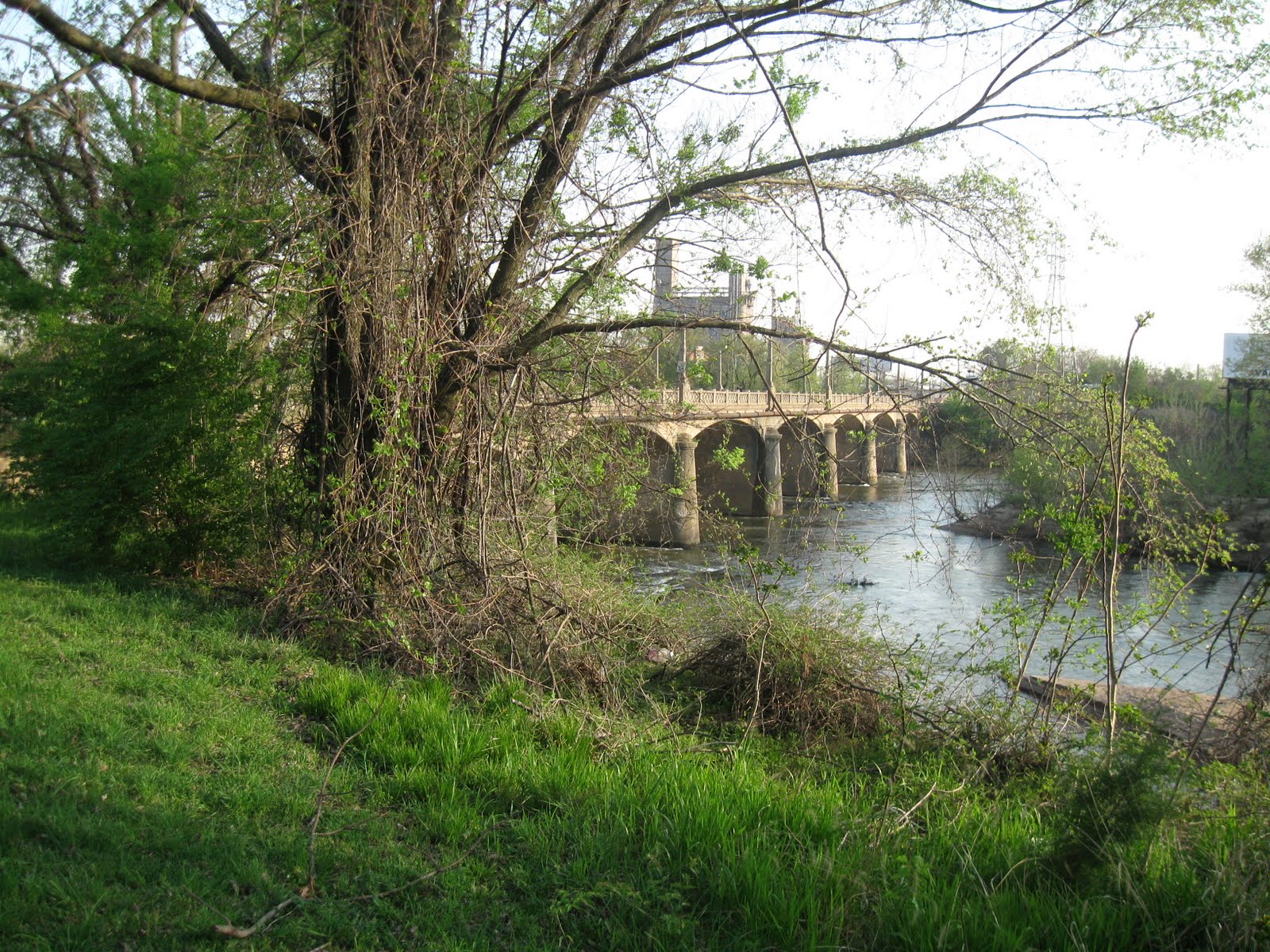
“First, What kind of life was lived in this place, that is, Why and how did its builders build as they did?
And second, what rules with general validity and applicability did they follow?”
Carroll William Westfall, Learning From Pompeii.


Saturday, May 8, 2010

Critical Consciousness and the Unchanging in Architecture

‹‹Bisogno fare qualsiasi cosa, fuorché l’invenzione di cose nuove: la vera invinzione è il non inventare nulla. Chi si rende consapevole di tutta l’inventabilità dell’inventabile è colui che non inventa nulla, perché ormai tutto quello di cui è capace questo nostro sistema planetario è già stato prodotto, ed è tutto qui: più esso sarà reinventato e piu sara posto in crisi. 
Ma occorre viceversa capirlo.
Dunque pianificare vuol dire lasciare lavorare la realtà, comprendendone il senso del miglior utilizzo››.

S. Muratori, Autocoscienza e realtà nella storia delle ecumeni civili, a cura di G. Maranucci, Roma 1976.

One question is of singular importance to the contemporary architect attempting to return to the classical tradition amidst the dissolving wake of the modernist movement. That question is “what is unchanging in architecture?” Tradition, in this sense, is the means by which we access truth. The adjective classical denotes works of architecture which are prized as the finest exemplars of a tradition. These are held up as models for the guidance of current practice and for the assurance of future success. Therefore, the form that the examples in a classical tradition take is necessarily contingent on the material requirements and propriety connected with both time and place.

The classical architecture of one era will not take shape in the same way as that of another, nor will the architecture of one place necessarily resemble that of a different place even at the same time. Conventions such as patterns of use, fashion, language and ways of building change over time and in different places, gaining their correctness through general acceptance and habit. This accepted knowledge and these skills and customs—-means by which we pursue the true, the beautiful and the good—-are guarded and handed on by the custodians of tradition to succeeding generations. As part of this transfer, the means of accessing truth is developed and changed according to the requirements of time and place. The tradition of one place may not be the same as that of another. The purpose of tradition is to bring into conformity the way we each pursue our ends in the particular with the best possible means of achieving those ends in the universal. In other words, tradition is the way in which our judgment is informed through the comparison of the way things are with the way things should be. Thus tradition is not about preserving a unique way of building, but of ensuring that our buildings are the best they can possibly be.

The concept of imitation is essential to an understanding of tradition. The idea of mimesis, first formulated by Aristotle in his Poetics, became an explicit principle of creative formation and procedure from ancient Greece until the end of the Renaissance.[i] As James Ackerman has noted, the concept of imitation was understood in two ways both for the ancients and the thinkers of the Renaissance.[ii] Imitation in art occurred both in mimesis—the imitation of nature or human behavior, and in the imitation of preceding artists. The first mode of imitation forms the framework in which moral judgment is made possible, while the second provides a means of translating these universal truths for a particular time and place.

Imitation, as Quatremere de Quincy enunciated as late as 1823, was seen not as mere copying of natural forms or previous works, but as the embodiment of apparent universal rules governing the production of beauty in the work of art.[iii] These rules could be extracted from nature and perfected over time through the imitation of predecessors in a tradition. As Ackerman points out, imitation is inherently forward looking. By this he means that the artist is able to use imitation during the creation of the work of art. This view is in opposition to that of modern art historians who use the concept of “influence,” an idea only debatable after the creation of the work of art and in the service of the art historian.[iv]


How are we then to judge what is essential in a tradition? What can be discarded in the face of improved technology, or to suit changing political or physical conditions? This question has undoubtedly been the starting point of all architectural endeavors and probably troubled the architects of the fourteenth century as much as it did the proponents of the eighteenth and nineteenth century revivals. In a world so full of varying forms it has been difficult to determine what concepts and categories should guide contemporary practice. Compounded with a seeming abundance of choices, the void left by modernism’s denial of tradition has exaggerated its self-proclaimed goal of severing us from the past. We are faced not only with the questions raised by the contingent reality of tradition itself, but by any attempt to restore a tradition that has been systematically eradicated.

As citizens of the United States our tradition is that of the West. This is not to say that the tradition of Greco-Roman-Judeo-Christian architecture is the only one in our country, or the first, but that it is the visible part of our “life, liberty and the pursuit of happiness.” The need to separate our new republic from the colonialism of England and justify our classically derived system of government prepared the United States for the embodiment of its constitution in an architecture of Western classicism. Little wonder that the author of the Declaration of Independence should also design the new Capitol of Virginia using the classicism of the Roman temple.

Fiske Kimball in his American Architecture asserts that “the classical ideal thus embodied was ultimately to rule in America to a degree unknown in Europe.”[v] Indeed, it was to precede it by more than a decade. The embodiment of the political order in the architecture of America is significant in that it points to the most essential truth of the classical tradition: the understanding that the highest good in life is the perfection of our nature, a good held since the Greeks to be accomplished through the moral life led in community. This is the self-evident truth behind the most just political systems of the past and the guiding principle in the American founding.

What this understanding means for architecture is that our ability to pursue our highest end as individuals is dependent on the freedom insured by our government, and that architecture serves this good as the embodiment of the state.[vi] In other words, architecture is the visible part of the more important activity of politics. Conversely, it is only in the freedom provided by well-ordered politics that architecture can be pursued. Vitruvius opens his De re aedificatoria by noting that it is in the realm of peace brought about by the Emperor Augustus’ conquest of the world that the opportunity and need for civic buildings arose, thus grounding architecture in a particular relationship with politics.[vii] Not only can mere building become architecture, but architecture can embody the polity and legitimate its claim to authority. By doing so, it can establish the means for its citizens to pursue the moral life.

Traditions are necessarily conventional. This means that they are contingent on materials, climate and circumstance. Conventional knowledge is particular, temporal and accidental, meaning that it could have been otherwise. Limited by the contingencies of both time and place, knowledge of convention is gained from experience and hearsay. The best pitch of a roof is dependant on the climate and characteristics of the location. That there exists a hierarchy of architectural orders and that they include an architrave, frieze and corona is not necessarily true (although the predominance of such features across traditions could point to a correspondence with a larger order). So too, the rules governing a given order’s proportions may vary with the changing requirements and traditions of the building and its purpose. Gaining as they do their acceptance through trial and error, such conventions are not necessary truths, or a priori knowledge, but point to a correspondence with an order outside of sense experience. Conventions have been adduced to be the best possible way of embodying the necessary truths of political life. Conventional knowledge on its own may be factually true and empirically verifiable, however, by its very nature it cannot be true in every instance. It can only tell us about the actual world and hence what is the case; it can say nothing about the ideal world and what should be the case.[viii]

When the American founders referred to the self-evident truths of life, liberty and the pursuit of happiness they were invoking the necessary truth of nature, the repository first described by the ancient Greeks of the true, the beautiful and the good.[ix] As a priori knowledge, these truths of nature can be known through reason independently of experience or empirical evidence and are understood as incontrovertible imperatives. In platonic terms Nature can be described as the intuitive realm of perfect forms; for Vitruvius she was “the architect [who] placed the hinges as central axes” of the earth.[x] For our purposes it is sufficient to say that nature is the totality of universal truths both known and unknown including the laws of physics, the rules of geometry and logic, and the truths described in the American Constitution such as justice, liberty, the equality of man, and the pursuit of happiness. Indeed, nature includes not only the natural objects around us such as plants, animals and rocks, but the system of principles by which things can be explained according to reason and which were true prior to their discovery. More importantly, nature provides the mark against which rational judgment is made possible, the moral order which allows us to state confidently that democracy is the best form of government because it has as its goal the good of every citizen, and the goal of all our efforts as human beings.

We can posit the idea of democracy, though a state where every citizen has been treated equally has never existed, because we can see that a state where some or all are not free is imperfect. In other words, the truth of nature is revealed only through the comparison of things we experience or accept with things we know to be true through reason. The truth of nature is self-evident, but it can only be accessed through our experience of conventional truth. As Socrates points out to Meno, people do not enquire into what they fancy they know, though they may in fact be entirely ignorant of it, unless they begin to compare what they think they know with the truth of nature.[xi] For example, we are gifted with the concept of justice at birth, but we must experience different embodiments of justice in practice to be able to understand perfect justice, and we must always be ready to reexamine our necessarily incomplete knowledge of justice. This Socratic doubt leading to the discovery of the order of nature—to the intrinsic, universal and enduring—is made possible only through out experience with the extrinsic, particular and transient we encounter in the here and now.[xii]

For the pagan writers of antiquity truth was embodied in number. The comparison between knowledge of convention and nature could be expressed through the concept of the part and its relationship with the whole. Number and the relation between numbers, or proportion, were seen as ideal frameworks upon which the basis of nature was modeled. The application of number and proportion to conventional material resulted in measure, and the correct use of number and proportion resulted in the beauty of the building. To phrase this another way, measure was meaning embodied in experience through beauty.

For Vitruvius, architecture depended upon number in the form of Order, Arrangement, Eurhythmy, Symmetry, Propriety and Economy. In the first place, “ordering is the proportion to scale of the work’s correspondence to an overall proportional scheme of symmetry.”[xiii] In other words, for the work to be beautiful it must initially conform to a geometrical framework extending to the subsequent design.[xiv] Arrangement, eurhythmy, symmetry, propriety and economy are aspects of this proportional application of number to material and depend on measure, which determines the relationships that make up proportion. At the center of this ideal proportional analogy Vitruvius placed the human body, described in the correspondence between the form of the extended human figure within the perfect geometric shapes of the square and circle.[xv] The anthropomorphic analogy was subsequently taken as the beginning of classical imitation and dominated architectural theory well through the sixteenth century.

According to Vitruvius the architect employs both conventional knowledge gained through experience, which Vitruvius termed fabrica, and the knowledge of the necessary truths of nature to explain a work’s beauty through ratiocinatio, or reasoned judgment. Just as the limbs of the body are proportioned in relation to the whole within a meaningful framework, beautiful buildings must have a relationship between their elements and the whole corresponding to their enduring purpose. The perfect geometrical forms within which the finite proportions of the human body are inscribed allow us to explain their beauty according to a higher meaning. Thus measure is essential for Vitruvius in the application of proportion to material, but only insofar as it serves the meaning inherent in the number it defines.

Renaissance thinkers such as Leon Battista Alberti took the tradition of Socratic skepticism, or the understanding that expertise must include both the knowledge of convention and of nature to its highest level, analytically breaking up all accepted thought into its constituent parts and reassembling them in a way that could answer the requirements of new and changing circumstances. Alberti, in his own words, "never stopped exploring, considering, and measuring everything, and comparing the information through line drawings, until [he] had grasped and understood fully what each had to contribute in terms of ingenuity and skill,” or until he had determined through measure the dimensions imitated by the ancients from nature.[xvi] Critical to this ability was the understanding that the content of a thing was more important then its form, and that form served as the access to a thing’s content.

The essence of the modernist movement lies in the mistaken belief that this Socratic doubt, instigated by our encounter with conventional truth, can only be answered by conventional truth, or fact. When Enlightenment thinkers realized the possibilities of the connection between natural and conventional truth based upon improvements in the science of measurement their Socratic doubt of received ideas turned to a revolutionary doubt in the very meaning of the universe. As soon as the measure of a thing (formerly a means of extracting a material object from a universal idea) became the thing’s very meaning, the imitation of nature by architects became pointless. While previous thought had held that regardless of the form of a thing such as the universe, the meaning behind it was immutable, the new view held that the way we perceive the universe, or the form of a thing, was all we could know about it, and therefore the way it should be.

Artists and architects, in the tradition of Socrates, have always questioned accepted truths and sought to translate them into the language of their own time. However, the Enlightenment’s rejection of inherent meaning required that artists’ translations could only be descriptive, meaning that they now relied on measure devoid of meaning. Imitation, in order to avoid the trap of mere copying, must be undertaken analytically. This means that, just as Alberti carefully studied all the ways in which the greatest buildings had treated specific conditions thereby arriving at an understanding of the universal they all pointed toward, imitation must be undertaken with a thorough knowledge of the whole body of traditional architecture and extract from each model pieces of the eventual solution for the given set of conditions. Imitation in the Enlightenment became the descriptive copying of the measurements and particulars of specific buildings. It was no longer the analytical treatment of precedents as a kit of parts capable of innumerable possibilities, all working within the framework of a building’s inherent purpose.

In order to judge what is essential in a tradition and what may be discarded in the face of improved technology, it will be necessary to recover our ability to think analytically. In other words, we must recover the understanding of imitation. The twentieth-century Italian architectural theorist Saverio Muratori has posited the existence of two types of consciousness essential to all architectural traditions. Spontaneous consciousness is entirely conventional and, though invariably traditional, lacks the analytical capacity for imitation. It could be described as something quite similar to Vitruvius’ fabrica, or practice. Spontaneous consciousness is simply the way things are built. Critical consciousness, on the other hand, represents the theoretical side of architecture. "When someone builds his own house with his own hands, he does not follow the dictates of the various architectural schools or currents and does not choose to build it out of structural steel or tree trunks without distinction: he does it as a house is built at that particular moment and in his own cultural area, thus acting in full spontaneous consciousness. Acting with critical consciousness is almost the opposite: when we are going through one of those critical periods . . . people are obliged to choose what they are doing, but let us make it clear, they do not choose having acquired greater maturity but out of uncertainty that what they are doing is right or wrong, in the absence of their community codifying what is right and wrong."[xvii] Muratori describes this modern absence of communal consensus as a crisis, carefully reminding us that the term does not necessarily denote a catastrophe, but rather the point at which an unresolved question is recognized and addressed. Critical consciousness is for Muratori both the cause of modernism and the only means of returning to and continuing architectural tradition. "If it is impossible to resuscitate spontaneous consciousness when we no longer have it, it is wise to exercise critical consciousness for the best. And the best that this can produce is to stick to the world of spontaneous consciousness, i.e. to recuperate what we would do if we had continued to operate through it."[xviii] It is only with our critical consciousness that we can regain the necessary ability to compare what is with what should be.

This is accomplished, according to Muratori, through the analytical “reading” [lettura] of the great buildings and cities of the past and the extraction from them of the essential human patterns of building. Rather than merely copying details—roof pitches, façades, column diminution or plans—the traditional architect must break down all the examples of the way in which buildings in the tradition conventionally treat specific problems, and from them reassemble a theory of universal types of architecture, both on the scale of the individual building scale and that of the larger city. Central to this endeavor is the understanding that although there may be new uses for buildings and cities, there are a limited number of building and urban types. These types derive from universal constants among buildings and cities.

Modernism attempted to replace spontaneous consciousness, a principle intimately linked with tradition, with a wholly theoretical vision of the future. As a result, however, architects have come to rely completely on conventional knowledge and the denial of analytical thought. In the attempt to enthrone critical consciousness as the sole means of producing art, modernist thinkers have been forced back upon conventional truth utterly devoid of theory and meaning. Modernism, for all its insistence on originality and freedom from tradition, is in fact a slave merely to the way things are done. Neoclassicism, the ultimate manifestation of modernism, is motivated to copy only particulars in just the same way that twentieth-century modern architecture can do nothing more than conform to the whims of its architect.

In order to comprehend what is unchanging in traditional architecture, we must understand that while conventional truth cannot prescribe the way things should be, it is the only means by which we are led to compare the way things are with the way they ought to be. Practice informs theory. Conventional knowledge provides the means by which we can access the order of nature. It is only through the analytical imitation of convention that we can apprehend the universal order of nature and make manifest the city of God.


NOTES

[i] Aristotle. The Basic Works of Aristotle. Ed. Richard McKeon. (New York: Random House, 1941), 478.
[ii] Ackerman, “Imitation.” Origins, Imitation, Conventions: Representation in the Visual Arts. (Cambridge, Mass: MIT Press, 2002), 64.
[iii] Quatremère de Quincy. An Essay on the Nature, the End, and Means of Imitation in the Fine Arts. Trans. J.C. Kent. (London: Smith, Elder and Co., Cornhill, 1837), 11.
[iv] Ackerman, 65.
[v] Kimball, American Architecture. (Indianapolis: The Bobbs-Merrill Company, 1928), 75.
[vi] Westfall, Carroll William, and Robert Jan van Pelt. Architectural Principles in the Age of Historicism. (New Haven: Yale University Press, 1991), 49.
[vii] Vitruvius, Marcus Pollio. Ten Books on Architecture. Trans. Ingrid D. Rowland. (New York: Cambridge UP, 1999), 21.
[viii] Westfall, Architectural Principles, 56.
[ix] Westfall, Carroll William. “Architecture and Democracy, Democracy and Architecture.” Democracy and the Arts. Ed. Arthur M. Melzer, et al. (Ithaca: Cornell University Press, 1999. 72-91), 76.
[x] Vitruvius, 109.
[xi] Plato. “The Meno.” The Collected Dialogues of Plato. Trans. Benjamin Jowett. (Princeton NJ: Princeton University Press, 1961), 389.
[xii] Westfall, in Architecture and Democracy, Democracy and Architecture, has described this doubt as “pious skepticism,” which has been replaced by the impious skepticism of modernity.
[xiii] Vitruvius, 24.
[xiv] Vitruvius, Commentary, 149.
[xv] Vitruvius, 47.
[xvi] Alberti, Leon Battista. On the Art of Building in Ten Books. Trans. Joseph Rykwert. (Cambridge, Mass: MIT Press, 1988), 155.
[xvii] Gianfranco Caniggia and Gian Luigi Maffei. Interpreting Basic Building: Architectural Composition and Building Typology. Florence, Italy: Alinea, 2001), 36.
[xviii] Caniggia and Maffei, 42.

Friday, April 9, 2010

Exploring Shockoe Slip and the Rock Landing


         Urbanismo continued the Tuesday evening tours of the oldest parts of Richmond. This week we visited the most organic section of the city, the area settled in the seventeenth century as the trading village of Shockoes. We looked at its connection with the Rock Landing. The landing served as the dock of Richmond until the new City Dock, an extension of the James River Canal, was fashioned in 1809. This section of the city is also the most heavily altered. Its broken lineaments often call on our most active imagination to visualize or even to locate the neighborhood in its historic context. 


         We began in the Shockoe Slip, one of Richmond's most appealing places and once the center of an international trade in flour and tobacco. In the nineteenth century, the city's crowded commercial district clustered around this small triangular plaza. The apppearance of the Slip has changed dramatically since the 1880s and even within our memory. The Shockoe Wareouse vanished long ago. The area continued to serve as a manufacturing and trading center until the 1960s. The buildings were eventually rehabilitated to serve as restaurants, bars, and shops, beginning in the 1970s.

           In many ways the Slip was more visually effective before the rehabilitation than it is today. The cobbles used to pave the plaza formerly ran right up to the fountain with only the stone bollards serving to keep the wagons at bay but allowing the horses to get up close. Please remove the foundation planting and the anachronistic horse-head top element with the light globe! Hasn't anyone seen pictures of Rome? 


               This map, dating from about 1809, is one of the first to show detail in the area around the Rock Landing, labelled near the center of the map. It appears the center of the town of Shockoes consisted of the row of lots along the landing including the "Ferry Lot," the alley behind, and the narrow cross street later called Fifteenth Street. This filled the area between Shockoe Creek and the base of the bluff. The low-lying meadows behind, through which the creek meandered, were left undeveloped  for any years.  The large empty section to the north is the Mayo property on Council Chamber Hill, soon to be subdivided into lots by Col. Mayo. The oddly shaped tracts to the west, corresponding to the high ground occupied by Shockoe Slip today, undoubtedly were the result of adaptations to the steep topography.


           Above is seen a map of the area around the mouth of Shockoe Creek, made about 1820. Shockoe Slip is in the lower left corner. It shows not only the informal shapes of the alleys and streets, but also the original curving shape of Shockoe Creek and the very narrow and straight new bed it received in the early nineteenth century just to the right of lot 334. The odd-shaped lots and crooked alleys date to the distribution of land here in irregular parcels corresponding to the curving route of the old road through the area and which were divided up into lots by the owners, principally Buchanan, Ross, Coutts and McPherson. The alleys, some lined with small lots, were given names such as Lombardy, Exchange, Cypress, True Heart, Tobacco, and Byrd's. The Rock Landing was now superseded by Water Street, seen in front of lots 323, 324, and 339. The "Old County Road" is Governor Street and was the principal way up the bluff to the top of Shockoe Hill.


The map detail above by Mijacah Bates from 1835 shows the former rock landing incorporated into the bank of the city dock with the lots that fronted on it still intact.


             The curving form of the Governor Street and the continued irregularity of its extension as Thirteenth Street to Cary is clear on this map and on the 1889 Sanborn Map 15 shown later. Above is a view from Main Street looking up "the old County Road." or Governor Street.


Shockoe Slip was located on the south side of Main Street at the foot of Governor Street, down which most of the hogsheads of up-country tobacco were rolled on their way to the great warehouses that had stood near this site since the late seventeenth century. Here the area is seen on an 1859 map.


The Shockoe Warehouse occupied a small bluff near the canal basin. The series of buildings that made up the warehouse were said to cover two and one-half acres in 1837 [Richmond Whig and Public Advisor, 1837]. They were typical of warehouse at the time: low brick walled structures that contained a grid of long roofed alleys with steep hipped roofs, lit and ventilated by regularly placed windows and separated by internal courtyards.


Below is a view of the exterior and interior of Seabrook's Warehouse on Seventeenth Street, similar in form. Tobaco warehouses appear to have opened directly without interior walls into the courtyards, as seen in the 1865 view from Harper's Magazine below. Seabrook's Warehouse was built in 1810 and demolished in 1910. Its site was reserved for public use and for a time was used as a public playground. It remains empty today.


Seabrook's Warehouse


Detail from early view of city from Manchester. The flat roof in center is the Shockoe Warehouse.
 The gabled building at center right is the office. The easterly slope from the slip is
visible at center right [Sanford, Richmond, 1975].


The polygonal section of the Shockoe Warehouse, seen at the top above on the 1876 Beers' Map of Richmond, came to a point at the triangular plaza now known as Shockoe Slip. According to research by Jeffrey Ruggles, the name Shockoe Slip was not formally applied on a map until 1873. Slip appears to have been a name traditionally applied to a passage or section of street used as a public space in Richmond. However, the similar small alley, seen at the bottom above, that ran behind the Sixth Street Market in 1876 was called "Market Slip." The vast tobacco crop produced in the Piedmont region was collected and inspected at these warehouses at the end of the James River and Kanawha Canal. Jeffrey Ruggles has uncovered some interesting photos of the Shockoe Warehouse at his very useful article on the origin of Shockoe as a name.


This 1865 photo from the Library of Congress shows the burned-out walls of the Shockoe Warehouse on top of the bluff to the upper right after the Evacuation Fire.


This image shows a fine oxcart in front of reconstructed Shockoe Warehouse c 1900-1910 with the Tobacco Exchange seen beyond along Shockoe Slip.


          The map shown above is a Sanborn Insurance Map of 1889. Shockoe Slip and the enormous Shockoe Warehouse are seen to the upper left and Fourteenth Street extends away to the lower right. The canal has been overlaid with a complex web of railroad tracks.

          The map at the very top of the blog, dating from 1781, shows three buildings at the site of the Shockoe Warehouse and two at the location of Byrd's Warehouse on Fourteenth Street.  Mordecai, Richmond's Herodotus, confirms that there were two warehouses (or "inspections") in this part of town in about 1800: Shockoe Warehouse, "a mere cluster of wooden sheds," and Byrd's, a brick structure on the northeast corner of Franklin and Fourteenth streets. Shockoe Warehouse shows up as a square structure on the west side of Thirteenth Street next on the 1809 map above. Byrd's, established in the late seventeenth century, and rebuilt and relocated several times, was long gone when Mordecai wrote and another warehouse had been built on the canal basin. In addition, Seabrook's Warehouse had been constructed in Shockoe Valley.


             The Shockoe Slip fountain was put up in 1910 to provide water to the draft animals that had arrived at their destination. It replaced a fountain that was in place as early as 1876 on the Beers' Map above. The Slip provided a open area at the entry gate of the great Shockoe Warehouse. It is the triangular building in the center of the map above. The warehouse was fronted by an arcaded Italianate market building, seen above. This housed the Tobacco Exchange, built after the Civil War. The site of the exchange, where the Martin Agency now stands, was to our back as we photographed the fountain.


              The plaza is undoubtedly the result of the crashing together of the irregular lanes of Shockoes with the regular grid of 1768 Shockoe Hill. The distinguished Columbian Block, with its third-floor Grain Exchange or market, forms the angled east side of the plaza. The Slip continues south as an angled street running toward the river.  


                It is immediately noticeable that the Slip is on an elevated arm or outcrop that projects from Shockoe Hill to a point just above the canal.  This is demonstrated by the deep, sunken alley to the rear of the Columbian Block seen here from ground level in the Slip. The Slip continues in the form of an angled street until it ends in a sharp declivity about a block to the south.


             To get reach the edge of the bluff, the Slip crosses Canal Street on a concrete bridge. Canal Street was cut through the outcrop in the early twentieth century, creating a dramatic juxtaposition of levels. The warehouse previously extended out and filled the entire hillock.  


          This view, photographed from the end of Shockoe Slip, shows the site of the Shockoe Warehouse.


          Returning to the entrance to the Slip at Main and Thirteenth streets, we passed a familiar sight- one of two cannons on Main Street doing sentry duty as bollards. This one used to stand at a much more rakish angle and was unpainted, as Urbanismo recalls in years gone by. We proceeded by way of Virginia Street to the gate in the flood wall at Fourteenth Street and walked along the river bank at the base of Shockoe Slip.


            The legendary sewer-pipe walkway under the railroad gave us a good view of the substantial granite embankment that runs along the entire river edge of Richmond from the site of the Haxall Mills to the the mouth of Shockoe Creek.  The new flood wall runs close behind it west of Fourteenth Street, but angles back to leave outside a large flat area east of Fourteenth Street, formerly the site of railroad yards.
          Here is the large, unoccupied area near the Fourteenth Street flood wall gates. Haxall Mills was located to the left, south of Shockoe Slip and powered by the water in the canal. After the demise of the canal system, the area around Fourteenth Street was used as a rail yard for the many trains entering Richmond from south of the river.   


       The Richmond Dock ran from Pear Street to Fourteenth Street. Here the western end is seen in an 1886 Sanborn Map. A small basin was located east of Seventeenth, where a drawbridge crossed the long, wide canal that formed the dock. Shockoe Creek ran under the dock basin roughly parallel to Sixteenth Street. It still empties into the river in the same location.The straight line to the left of the creek's mouth represents the stone embankment.


                This drawing shows the drawbridge that allowed Seventeenth Street to cross the Richmond Dock. The company of Davenport and Morris, seen above on Dock Street in 1893. According to the maps shown above and to the testimony of Mordecai, the Rock Landing is buried immediately to the left, out of the picture, under the site of the Richmond gas works.   


             Urbanismo followed the stone river embankment past the graceful arches of Fourteenth Street (formerly Mayo's) Bridge and then proceeded back through the floodwall and along Fourteenth Street up toward Main Street.


        Here we saw the former Richmond Hardware Company Building on the right at Fourteenth and Dock street and the old Southern RR Depot (it lost its south end to the new canal project). The Rock Landing was about one square to the east (right).


Here the curving irregularity of Fourteenth Street shows its pivotal position. The angled route to Mayo's Bridge meets the 1737 grid to the right and the less regular street patterns to the left. The vacant lot in the center of the photograph above was the location of the frame building that served as the Capitol until Jefferson's temple-form building could be completed on the hill. This photo was taken before the current hotel stood on the site.   


         This Sanborn Map from 1889 shows the squares north of Cary from Thirteenth to Fifteenth streets. Lombard Alley is located in the center of the lower left-hand square. Except for the southeast quadrant east of Virginia Street, the buildings and alley remain largely intact. Lombard Alley is seen below left looking west from Fourteenth Street. The extension of the alley to the east is seen to the right .


              Here on the right is that characteristic Richmond feature, the parking kiosk. The photograph on the left shows the west end of Lombard Alley looking east from Thirteenth Street. A series of stone bollards protected the building's foundation. 


            Urbanismo finally returned to the Shockoe Slip. To the left is a view along Cary Street looking west from Thirteenth and, on the right, a view of the wonderful scribed granite sidewalk slabs at the corner of Thirteenth and Cary. The variety in sidewalks in the area confirms Mordecai's remark that "the dealers who wished to entice the ladies into their shops (stores, I beg pardon) would present a paved entrance; those who sought rougher customers offered a rough reception, over gravel or cobble stone." Here, there are three kinds of finishes on the enormous stones, designed to give good traction. Some were diagonally grooved, others given a straight groove, and still others treated with a bush hammer. The corner stones were given a miter joint.

            Urbanismo will continue the touring later with a look at nearby Council Chamber Hill.

Monday, March 29, 2010

URBAN PALIMPSESTS


                   Urbanismo took the opportunity of spring-like weather last week to explore the urban fabric of the oldest part of Richmond.  A small company, including an obliging photographer, walked the boundaries of the original 1737 town. A pedestrian's view of the city brought home the geographic, historic, and architectural complexity of the neighborhood. Since we walked the boundary of the district (with a few divergations), we didn't, by any means, look at all the buildings and streetscapes. We began, as seen above, with a walk south along 17th, beginning at the location, since 1782, of the city's market.  17th Street (originally 1st Street) was the westernmost edge of the town until the 1760s. The market was built on the city's common, where washing was done in Shockoe Creek, which flows underground just beyond the former YMCA Hotel in the background.


               A quick review: The conventional "Tidewater" town of Richmond was laid out at the falls of the James River in 1737.  An uninflected 28-block rectangular grid was organized along an axis formed by a pre-existent road on the natural terrace above the river’s edge, extending southeast from the ford of Shockoe Creek that separated it from an earlier settlement called "Shockoes." The market was eventually located just left of the added range of lots identified by the letters A to O on this copy of the famous Mayo plan. Lots 97 and 98 at the upper right were donated to be the site of the town's church and churchyard by William Byrd II. Our trip takes us around the outside edge of the grid starting in the lower left-hand corner and proceeding counter-clockwise.


        Each two-acre block or “square” contained four nearly square lots and was separated from adjacent blocks by sixty-five-foot-wide streets.  The banks along Shockoe Creek and the waterfront outside the grid were designated as a common for the use of residents in pasturing, fishing, or other activities. The lots filled in over the next 130 years. The section is seen in the 1864 woodcut above looking west from the east end of town with Church Hill on the right.


                   We moved down to the southwest corner of the town, not too far from the edge of Shockoe Creek and the now-invisible site of the Rock Landing, where goods were loaded for the trip down river. This view shows the overhead railroad tracks that create, with the elevated Interstate 95, a shadow over the old landing place.  These are some of the late-nineteenth-century industrial buildings that replaced the houses, shops, and warehouses that made up the former streetscape near the edge of the port of Richmond.


               The ancient connection of this section of the city with the sale and processing of tobacco is apparent here on 18th Street near Cary and in later photographs that show the many warehouses and factories dedicated to its preparation for sale. The two buildings flanking the street, with their tall, deeply shadowed facades, are the among the most architecturally powerful of Richmond's industrial structures. 


               Urbanismo continued along the southern edge of the 1737 town. This parking lot at the corner of Cary and 19th streets is an example of the open land that serves the parking demands of the city but works against the potential urban heath of the district.


           The long, impressive row of twentieth-century tobacco factories, converted for institutional and residential purposes, line the terrace of land above the city's historic port. Before the change to heavy industry, the section facing Main Street had been home to several generations of stores with accommodation above for the shop-keeper's family. Several fires in the early nineteenth century prompted the replacement of the frame shops with brick commercial buildings, often built by developers in rows of two or more stores. 

          The squares on the south side of Cary Street (to the right in the snapshot) were part of the town's common land and were sold in the 1780s to finance the construction of the new public buildings associated with the move of the capital to Richmond.


            The lots became waterfront property in 1816 with the construction of the Richmond Dock on the north side of Chapel Island. In about 1850, John Enders built a row of fourteen warehouses on these lots between 18th and 21st streets to serve the shipping of goods by boat. Several of the warehouses burned, but those that remained (seen above) were utilized by the Confederate government to house Libby Prison.The warehouses along the water-front were replaced by lumber yards and small industry in the late nineteenth century.


           Here the tour proceeded east along Main Street. The factories fill much of the southern side of the street, while a later generation of twentieth-century stores occupy the north side and sections of the south.


            The location of the old Henrico County Courthouse always seemed strange, since Richmond was removed from Henrico in the late eighteenth century when it was made a city. It persisted at this location and served as the heart of the city's public life until the city received a government and a market hall in 1782. 


           The courthouse was built in 1750 and located in the middle of 23rd Street. Since the town lacked any public land on Main Street, the court took advantage of the cross street to provide a specialized building at an urban scale and in a position that rhetorically accentuated its public purpose. That building was replaced in 1850 with the building shown above. The current building, embedded in the factory row, was constructed in the late nineteenth century. 


                The extraordinary miniature bridge of sighs built of corrugated iron and leading from the jail to the courtroom had eluded the attention of Urbanismo for many years. 


          This poured concrete addition to the rear of the courthouse has architectural atractions not unrelated to Regency-era London. 


           The view from the original courthouse location shows the dominance of the site on the bluff of the eighteenth-century home of the prominent Adams family. Their neighbor, William Palmer, built the house still standing at the summit of the hill about 1810. Enlarged in 1859, it forms the centerpiece of the nineteenth-century Convent of the Visitation, now the ecumenical center called Richmond Hill. Franklin Street runs at the foot of the bluff.


         This image shows the buildings that crowned the bluff in the late nineteenth century. In the foreground is the 18th-century Richard Adams House. The enlarged Palmer House is seen in the distance.


                  This store/residence on the north side of Main Street between 21th and 22st streets is one of few along the street to date to antebellum times.


          The surviving row of brick shops across Main Street, although built in the late nineteenth century, provides a valuable sense of urban continuity.


               The strong brickwork and articulated facades of these factories provides an exhilarated perspective of the city dock, elevated railroad, and the river beyond.


              At Main and 25th streets, Urbanismo paused to better understand the topography, so easy to miss from a car.  Main Street slopes gently up from Seventeenth Street. Here we stand at the eastern end of the William Byrd II town looking up 25th Street toward St. John's Church. Although the slope has been amended during the nineteenth century, it is clear that this was always the place where the bluff could be ascended.  


            As we proceeded up 25th Street, the character of the revitalized neighborhood of Church Hill overrides the mixed building stock of Main Street.  Early nineteenth-century buildings, like the 1846 frame house in the center distance, survive amid bland infill, like the Charity Square Condominiums on the right and antebellum tobacco factories like the Turpin-Yarbrough Building on the left, now known as the Pohlig Brothers Paper Box Company.  


         Building on hilly land involves a lot of grading and has the potential to make ideal places for urban gardening. Here are some of the granite retaining walls found all around Richmond. This one is seen from the alley on the east side of 25th Street north of Franklin. The early spring garden belongs the frame house seen in the previous photograph.


            The first section of Richmond and the addition to the town on Shockoe Hill were laid out, as was the long custom in Virginia,  in two-acre blocks (always properly called "squares"). The owner of each half-acre lot was free to build facing any adjoining street and to subdivide the lot in any manner he chose. Thus standard lots and regular alleys are not to be met with in Richmond east of First Street. Such alleys as exist are the result of the provisions of generations of developers and of negotiations between adjoining owners.                


              The ways of alleys in the older parts of Richmond are unpredictable. A brief detour also provided a great reward. The alley between Grace and Broad streets turned and dwindled to a narrow cobbled path as we approached 25th Street not far from St. Patrick's Church. 


                   As we turned the corner at St. John's Churchyard and walked west on Broad Street, the northern edge of Richmond in 1737, we looked across at the Patrick Henry Park, a well-meant bit of 1950s urban redevelopment. The park and the adjacent firehouse were part of the deliberate effort to give a dignified setting to St. John's Church by the removal of a square full of "unsightly and unsuitable" buildings.  In fact the square remains empty most of the time and robs the churchyard of a strong northern edge.  As currently laid out, the park contributes less to the civic good than would a block of houses and shops. 

                The high brick walls all around the churchyard show the degree to which the streets have been cut down to improve street grades.


                  Carrington Row, one of Richmond's most important examples of Neo-classical domestic  architecture, is a row of three dwellings unified with a marching row of stucco antae (a kind of Greek pilaster) and an abstracted Greek Doric entablature. Carrington Row served in 1957 as a pilot project for the creation of a kind of "Old Town," which at that time Richmond wholly lacked.  The managers of the Historic Richmond Foundation were able to act with more abandon in 1957 than they would be today. All over Church Hill porches were removed or restored, and at Carrington Row the restorers whimsically left the added Greek Revival porch at the east end and the Italianate hood at the west end. Only the central opening retains its original appearance.    


              The gardens to the rear and the brick and cast iron urban mews park along the alley are wonderful evocations of the restraint, humanity, and civic largesse that could be brought by landscape designers and their patrons to urban projects in the post-War era.  These gardens, designed by the firm of Griswold, Winter, and Swain of Pittsburgh and carefully maintained for fifty years by volunteers, manage to express the scale, detail, and ease of a private landscape in a public setting.  

              Here is a good view also of the characteristic treatment of paving in Church Hill. The sidewalks are laid in red paving bricks in a herringbone pattern. The alleys are paved with cobbles, laid with less rigor, but always with a central gutter. A distinctive apron is provided wherever the alleys cross the sidewalks.  In some cases these aprons may be the remains of the adjoining street paving, but it provides an important and consistent color and material palette giving welcome depth to the city's design language.  


             Our trek brought us now to the long slope down from church hill to the bottom of Shockoe Valley. It is hard to realize that Broad Street did not connect across the Shockoe Valley or climb Church Hill until well into the nineteenth century.  As we walked the old herringbone sidewalks, we enjoyed looking a the variety of houses that still line Broad Street from the top of the hill to the bottom.  Whether built in 1850, 1880, or 1910, the houses have a remarkable family resemblance. The emphasis on decorative fashion that we learn from publishers of style handbooks conceals the essential typological continuity of the Richmond urban house.


               As we saw at the top of the hill Richmond  houses were often built by developers in block of two, three, or more row houses. Where the land is sharply graded and an alley is impossible to provide, some Richmond houses have narrow tunnels between the English basements to allow service access to the rear. In this brick double house midway along Broad Street the chimneys shared by the two dwellings are supported on overhead arches.


            This lot on the south side of Broad Street, is typical of the many empty spots in the Shockoe Valley. Infill housing had begun to re-edge Broad Street just before the recent economic collapse. While much of the new housing is shallow in its concept and detailing, it is in the right place.  


            Here we turned south along the western edge of 1737 Richmond. The Market is ahead of us and the cupola of the Masonic Hall visible to the left. There is a lot of empty space in this area, much of it parking for the nightspots in the market area. This is the area that would have be radically transformed by the proposed ball park.  It isn't clear what will happen in the next decade, but the past one has been great for the urban fabric of Richmond. Fueled by the Historic Preservation Tax Credit, the citizens of the city have renewed the vast majority of the city's historic buildings in much the same way that they were built, spontaneously. There has been little government intervention in the historic area, few large-scale development schemes with the influence to make changes at an urban scale, and there are few franchise restaurants or businesses in the historic area. 


            A variety of owner-operated businesses, dense occupied housing, and active foot traffic gave evidence of Richmond’s health and the depth of its revitalization.  Another, less obvious, demonstration of the city's strength was the extreme diversity of building types and ages.  Instead of a homogeneous fabric of historic buildings, the variety of buildings indicates the depth of history and the long-term vitality of the city in the American context. In fact, only three buildings survive from the eighteenth century and very few from even the antebellum period. Most date from successive rebuildings in the late nineteenth century and the early twentieth century. 


               Urbanismo promises to keep walking and keep looking. Next week we plan to examine the street patterns of the old town of Shockoes and of Council Chamber Hill, followed by an expedition to examine the boundaries of the 1768 plat of the extension of the city onto Shockoe Hill.