

Urbanismo continued the Tuesday evening tours of the oldest parts of Richmond. This week we visited the most organic section of the city, the area settled in the seventeenth century as the trading village of Shockoes. We looked at its connection with the Rock Landing. The landing served as the dock of Richmond until the new City Dock, an extension of the James River Canal, was fashioned in 1809. This section of the city is also the most heavily altered. Its broken lineaments often call on our most active imagination to visualize or even to locate the neighborhood in its historic context.

We began in the Shockoe Slip, one of Richmond's most appealing places and once the center of an international trade in flour and tobacco. In the nineteenth century, the city's crowded commercial district clustered around this small triangular plaza. The apppearance of the Slip has changed dramatically since the 1880s and even within our memory. The Shockoe Wareouse vanished long ago. The area continued to serve as a manufacturing and trading center until the 1960s. The buildings were eventually rehabilitated to serve as restaurants, bars, and shops, beginning in the 1970s.
In many ways the Slip was more visually effective before the rehabilitation than it is today. The cobbles used to pave the plaza formerly ran right up to the fountain with only the stone bollards serving to keep the wagons at bay but allowing the horses to get up close. Please remove the foundation planting and the anachronistic horse-head top element with the light globe! Hasn't anyone seen pictures of Rome?


This map, dating from about 1809, is one of the first to show detail in the area around the Rock Landing, labelled near the center of the map. It appears the center of the town of Shockoes consisted of the row of lots along the landing including the "Ferry Lot," the alley behind, and the narrow cross street later called Fifteenth Street. This filled the area between Shockoe Creek and the base of the bluff. The low-lying meadows behind, through which the creek meandered, were left undeveloped for any years. The large empty section to the north is the Mayo property on Council Chamber Hill, soon to be subdivided into lots by Col. Mayo. The oddly shaped tracts to the west, corresponding to the high ground occupied by Shockoe Slip today, undoubtedly were the result of adaptations to the steep topography.

Above is seen a map of the area around the mouth of Shockoe Creek, made about 1820. Shockoe Slip is in the lower left corner. It shows not only the informal shapes of the alleys and streets, but also the original curving shape of Shockoe Creek and the very narrow and straight new bed it received in the early nineteenth century just to the right of lot 334. The odd-shaped lots and crooked alleys date to the distribution of land here in irregular parcels corresponding to the curving route of the old road through the area and which were divided up into lots by the owners, principally Buchanan, Ross, Coutts and McPherson. The alleys, some lined with small lots, were given names such as Lombardy, Exchange, Cypress, True Heart, Tobacco, and Byrd's. The Rock Landing was now superseded by Water Street, seen in front of lots 323, 324, and 339. The "Old County Road" is Governor Street and was the principal way up the bluff to the top of Shockoe Hill.

The map detail above by Mijacah Bates from 1835 shows the former rock landing incorporated into the bank of the city dock with the lots that fronted on it still intact.

The curving form of the Governor Street and the continued irregularity of its extension as Thirteenth Street to Cary is clear on this map and on the 1889 Sanborn Map 15 shown later. Above is a view from Main Street looking up "the old County Road." or Governor Street.

Shockoe Slip was located on the south side of Main Street at the foot of Governor Street, down which most of the hogsheads of up-country tobacco were rolled on their way to the great warehouses that had stood near this site since the late seventeenth century. Here the area is seen on an 1859 map.
The Shockoe Warehouse occupied a small bluff near the canal basin. The series of buildings that made up the warehouse were said to cover two and one-half acres in 1837 [Richmond Whig and Public Advisor, 1837]. They were typical of warehouse at the time: low brick walled structures that contained a grid of long roofed alleys with steep hipped roofs, lit and ventilated by regularly placed windows and separated by internal courtyards.
Below is a view of the exterior and interior of Seabrook's Warehouse on Seventeenth Street, similar in form. Tobaco warehouses appear to have opened directly without interior walls into the courtyards, as seen in the 1865 view from Harper's Magazine below. Seabrook's Warehouse was built in 1810 and demolished in 1910. Its site was reserved for public use and for a time was used as a public playground. It remains empty today.


Seabrook's Warehouse

 |
| Detail from early view of city from Manchester. The flat roof in center is the Shockoe Warehouse. The gabled building at center right is the office. The easterly slope from the slip is visible at center right [Sanford, Richmond, 1975]. |

The polygonal section of the Shockoe Warehouse, seen at the top above on the 1876 Beers' Map of Richmond, came to a point at the triangular plaza now known as Shockoe Slip. According to research by Jeffrey Ruggles, the name Shockoe Slip was not formally applied on a map until 1873. Slip appears to have been a name traditionally applied to a passage or section of street used as a public space in Richmond. However, the similar small alley, seen at the bottom above, that ran behind the Sixth Street Market in 1876 was called "Market Slip." The vast tobacco crop produced in the Piedmont region was collected and inspected at these warehouses at the end of the James River and Kanawha Canal. Jeffrey Ruggles has uncovered some interesting photos of the Shockoe Warehouse at his very useful article on the origin of Shockoe as a name.

This 1865 photo from the Library of Congress shows the burned-out walls of the Shockoe Warehouse on top of the bluff to the upper right after the Evacuation Fire.


The map shown above is a Sanborn Insurance Map of 1889. Shockoe Slip and the enormous Shockoe Warehouse are seen to the upper left and Fourteenth Street extends away to the lower right. The canal has been overlaid with a complex web of railroad tracks.
The map at the very top of the blog, dating from 1781, shows three buildings at the site of the Shockoe Warehouse and two at the location of Byrd's Warehouse on Fourteenth Street. Mordecai, Richmond's Herodotus, confirms that there were two warehouses (or "inspections") in this part of town in about 1800: Shockoe Warehouse, "a mere cluster of wooden sheds," and Byrd's, a brick structure on the northeast corner of Franklin and Fourteenth streets. Shockoe Warehouse shows up as a square structure on the west side of Thirteenth Street next on the 1809 map above. Byrd's, established in the late seventeenth century, and rebuilt and relocated several times, was long gone when Mordecai wrote and another warehouse had been built on the canal basin. In addition, Seabrook's Warehouse had been constructed in Shockoe Valley.

The Shockoe Slip fountain was put up in 1910 to provide water to the draft animals that had arrived at their destination. It replaced a fountain that was in place as early as 1876 on the Beers' Map above. The Slip provided a open area at the entry gate of the great Shockoe Warehouse. It is the triangular building in the center of the map above. The warehouse was fronted by an arcaded Italianate market building, seen above. This housed the Tobacco Exchange, built after the Civil War. The site of the exchange, where the Martin Agency now stands, was to our back as we photographed the fountain.

The plaza is undoubtedly the result of the crashing together of the irregular lanes of Shockoes with the regular grid of 1768 Shockoe Hill. The distinguished Columbian Block, with its third-floor Grain Exchange or market, forms the angled east side of the plaza. The Slip continues south as an angled street running toward the river.
It is immediately noticeable that the Slip is on an elevated arm or outcrop that projects from Shockoe Hill to a point just above the canal. This is demonstrated by the deep, sunken alley to the rear of the Columbian Block seen here from ground level in the Slip. The Slip continues in the form of an angled street until it ends in a sharp declivity about a block to the south.


To get reach the edge of the bluff, the Slip crosses Canal Street on a concrete bridge. Canal Street was cut through the outcrop in the early twentieth century, creating a dramatic juxtaposition of levels. The warehouse previously extended out and filled the entire hillock.

This view, photographed from the end of Shockoe Slip, shows the site of the Shockoe Warehouse.

Returning to the entrance to the Slip at Main and Thirteenth streets, we passed a familiar sight- one of two cannons on Main Street doing sentry duty as bollards. This one used to stand at a much more rakish angle and was unpainted, as Urbanismo recalls in years gone by. We proceeded by way of Virginia Street to the gate in the flood wall at Fourteenth Street and walked along the river bank at the base of Shockoe Slip.


The legendary sewer-pipe walkway under the railroad gave us a good view of the substantial granite embankment that runs along the entire river edge of Richmond from the site of the Haxall Mills to the the mouth of Shockoe Creek. The new flood wall runs close behind it west of Fourteenth Street, but angles back to leave outside a large flat area east of Fourteenth Street, formerly the site of railroad yards.
Here is the large, unoccupied area near the Fourteenth Street flood wall gates. Haxall Mills was located to the left, south of Shockoe Slip and powered by the water in the canal. After the demise of the canal system, the area around Fourteenth Street was used as a rail yard for the many trains entering Richmond from south of the river.


The Richmond Dock ran from Pear Street to Fourteenth Street. Here the western end is seen in an 1886 Sanborn Map. A small basin was located east of Seventeenth, where a drawbridge crossed the long, wide canal that formed the dock. Shockoe Creek ran under the dock basin roughly parallel to Sixteenth Street. It still empties into the river in the same location.The straight line to the left of the creek's mouth represents the stone embankment.

This drawing shows the drawbridge that allowed Seventeenth Street to cross the Richmond Dock. The company of Davenport and Morris, seen above on Dock Street in 1893. According to the maps shown above and to the testimony of Mordecai, the Rock Landing is buried immediately to the left, out of the picture, under the site of the Richmond gas works.

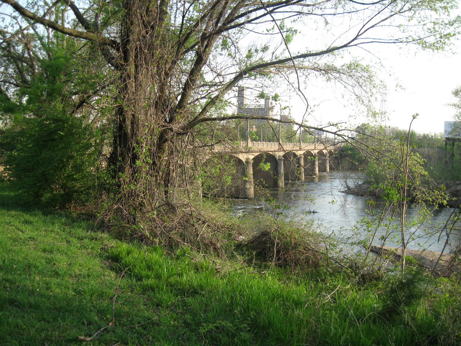
Urbanismo followed the stone river embankment past the graceful arches of Fourteenth Street (formerly Mayo's) Bridge and then proceeded back through the floodwall and along Fourteenth Street up toward Main Street.

Here we saw the former Richmond Hardware Company Building on the right at Fourteenth and Dock street and the old Southern RR Depot (it lost its south end to the new canal project). The Rock Landing was about one square to the east (right).

Here the curving irregularity of Fourteenth Street shows its pivotal position. The angled route to Mayo's Bridge meets the 1737 grid to the right and the less regular street patterns to the left. The vacant lot in the center of the photograph above was the location of the frame building that served as the Capitol until Jefferson's temple-form building could be completed on the hill. This photo was taken before the current hotel stood on the site.
This Sanborn Map from 1889 shows the squares north of Cary from Thirteenth to Fifteenth streets. Lombard Alley is located in the center of the lower left-hand square. Except for the southeast quadrant east of Virginia Street, the buildings and alley remain largely intact. Lombard Alley is seen below left looking west from Fourteenth Street. The extension of the alley to the east is seen to the right .


Here on the right is that characteristic Richmond feature, the parking kiosk. The photograph on the left shows the west end of Lombard Alley looking east from Thirteenth Street. A series of stone bollards protected the building's foundation.
Urbanismo finally returned to the Shockoe Slip. To the left is a view along Cary Street looking west from Thirteenth and, on the right, a view of the wonderful scribed granite sidewalk slabs at the corner of Thirteenth and Cary. The variety in sidewalks in the area confirms Mordecai's remark that "the dealers who wished to entice the ladies into their shops (stores, I beg pardon) would present a paved entrance; those who sought rougher customers offered a rough reception, over gravel or cobble stone." Here, there are three kinds of finishes on the enormous stones, designed to give good traction. Some were diagonally grooved, others given a straight groove, and still others treated with a bush hammer. The corner stones were given a miter joint.

Urbanismo will continue the touring later with a look at nearby Council Chamber Hill.


